While we wait for the dark theme of Google Maps to reach the whole world we see how Google announces the upcoming news Live View, with new features that will improve navigation with augmented reality.
Google Maps Live View has improved in its first year of life our way of get around on foot in the cities, and thanks to the following news, it will be even more difficult to get lost.
What’s new in Google Maps Live View
New benchmarks
Along with the arrows, directions and distance markers we will soon see new points of reference to help us orient ourselves more easily. Live View can show us how far we are from emblematic places such as the Empire State Building in New York or the Pantheon in Rome, and easily recognizable places such as local parks and sights.
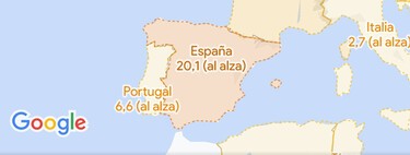
These new landmarks will soon reach almost 25 cities, of which we find two Spanish cities. The cities are Amsterdam, Bangkok, Barcelona, Berlin, Budapest, Dubai, Florence, Istanbul, Kuala Lumpur, Kyoto, London, Los Angeles, Madrid, Milan, Munich, New York, Osaka, Paris, Prague, Rome, San Francisco, Sydney, Tokyo and Vienna.
Live View in more places
Google Maps adds a shortcut Live View in the transit tabSo when we have to continue the journey on foot we just have to tap on ‘Live View’ to start the augmented reality navigation.
Live View in the shared location
Last september Live View reached the shared location, but only on Pixel devices. In augmented reality you will be able to see the position of the person at all times to easily reach them. This feature is coming soon to all supported Android and iOS mobiles.
A more accurate pin
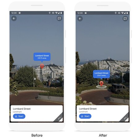
Lastly, the Live View pin is now more accurate. Machine learning has been enhanced to take the elevation of a location into account so that it can correctly display the location of the PIN. Before, on steep streets, I could place the marking in the air, giving the feeling that our destination was further away.

Maps – Navigation and public transport
Via | Google