Google maps It has not stopped evolving since its launch 15 years ago, especially in recent years such as offline maps, popular hours, radars or the report of traffic incidents. Now your next renewal to the most important of your application, to the maps.
From this week we will begin to see new maps, with maps more detailed, more colorful and most importantly: more precise. The last renovation was almost three years ago, at the end of 2017.
This is how the new Google Maps are
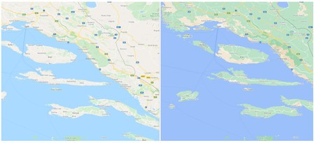
Left: Before | Right: Now
Thanks to the high definition satellite images for more than 98% of the planet that Google has captured and a new algorithmic color mapping technique, now Google maps will offer more complete maps, with new colors that allow us see its natural characteristics that will allow us to easily differentiate arid areas from areas rich in vegetation, or from snowy areas, differentiating the level of vegetation with different shades of green or brown for the more arid areas using the HSV color model.

Thanks to the new detail and colors of the Google Maps maps, we will better understand what an area is like without having to activate its satellite view, with a simple glance we can locate arid, frozen, wooded or mountainous regions. But this is not all.
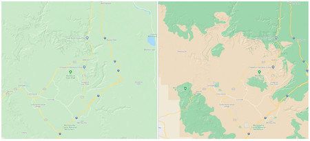
Left: Before | Right: Now
More precise streets, pedestrian crossings
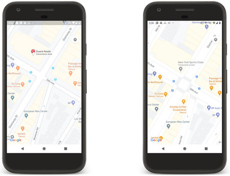
Google Maps also begins to add more detailed maps for cities. In the coming months, new maps for London, New York and San Francisco will arrive, with more accurate street information, accurately showing the width of a road to scale together to the crosswalks, sidewalks, and pedestrian islands. In the future they will expand these new maps to the main cities of the world.